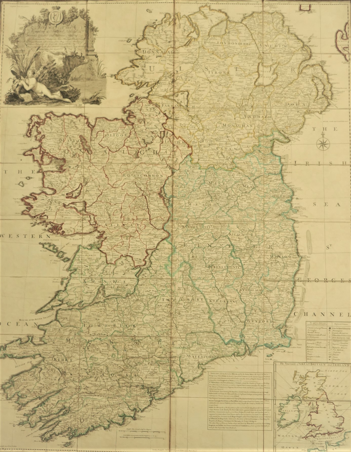


A Map of the Kingdom of Ireland (1790)
Book ID: 65077
Price: €850.00
A Map of the Kingdom of Ireland. Published 1790. Handsome map on folded canvas, housed in original cardboard sleeve. A very good copy.
Decorated with a large patriotic elaborate rococo cartouche of a nude figure lying among reeds and rushes holding a churn paddle and a spilled milk pail. Inset is a chart of the seacoasts of Great Britain and Ireland. Counties in outline colour. Shows classified roads with distances, etc.
John Rocque was Topographer to the Prince of Wales and attained his new title after the coronation in 1760. He flourished from 1734-62.
Out of stock
