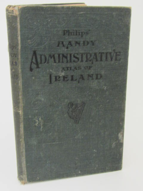


Philip’s Handy Administrative Atlas of Ireland (1909)
Book ID: 59931
Price: €95.00
Philip’s Handy Administrative Atlas of Ireland. A Series of Detailed County Maps showing Local Government and Parliamentary Divisions. With lists of County Boroughs, Municipal Boroughs, Urban Districts, Rural Districts, Parliamentary Boroughs and Divisions, and Consulting Index. London: Phillip, [1909]. Publishers cloth boards, printed in black with ornate design embossed in blind to upper cover, title page printed in red & black. Covers lightly scuffed, title page spotted, otherwise a very good copy.
Contains 4 maps of Ireland, 32 county maps in colour, and map of the Environs of Dublin. With a list of the Parliamentary Boroughs in Ireland along with County Boroughs, Municipal Boroughs, Urban Districts and Rural Districts in Ireland.
“In this Atlas, the attempt is made for the first time to present .the actual Administrative Divisions of Ireland as they exist at the present time for all purposes of Local Government and Parliamentary Representation.”
Out of stock
